
Skywatching / Updated 2026-07-16 / 3 min read
Lenticular cloud or UFO? How to tell the difference
Smooth lens-shaped clouds can resemble discs or stacked craft, especially near mountains and at sunrise or sunset. Weather context usually resolves the comparison.
Reviewed and maintained byGlobal UFO Archive Editorial DeskEditorial policy
Quick answer
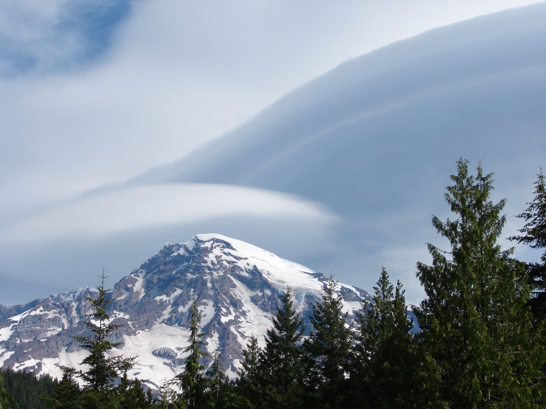
A smooth lens, almond or stacked-saucer shape that remains near mountainous terrain while changing slowly is often a lenticular cloud. These clouds form in standing atmospheric waves as stable, moist air crosses elevated terrain. Check the wind direction, nearby mountains, cloud texture, duration and local weather imagery. A lenticular explanation is weaker when a clearly bounded luminous object moves independently of the wind and is recorded against fixed references.
Key points
- NOAA and the National Weather Service describe lenticular clouds as lens-shaped formations commonly associated with airflow over terrain.
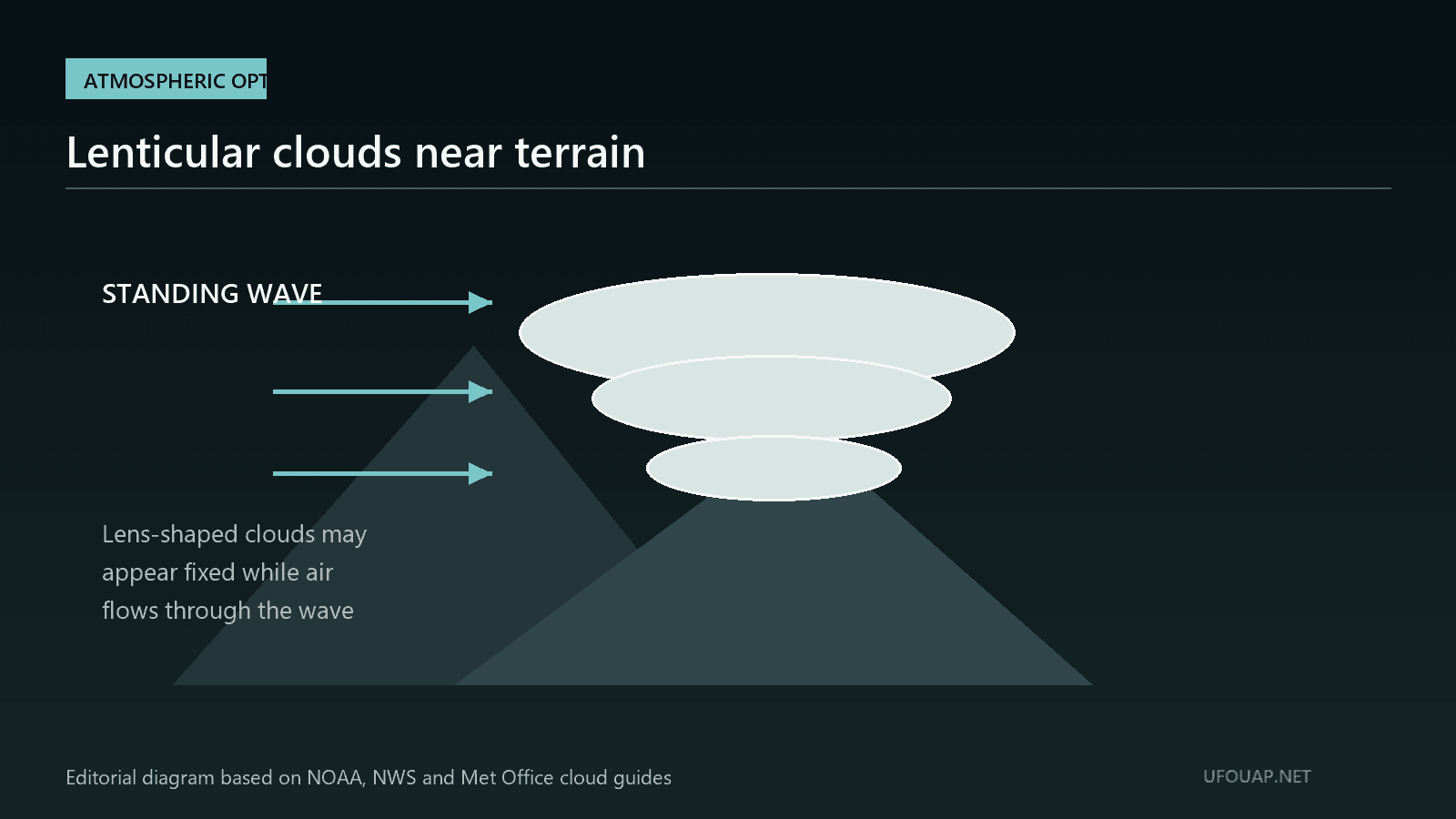
- They can look stationary even though air is continuously moving through the standing wave that forms them.
- Time-lapse imagery, terrain position and weather records are more useful than the familiar saucer outline alone.
Why lenticular clouds look unusual
Lenticular clouds often have smooth edges, strong symmetry and one or more stacked layers. Low-angle sunlight can tint them orange, pink or silver and make the edges appear bright while the surrounding sky is dark. A cropped photograph removes scale and terrain, leaving a shape that resembles a disc. The resemblance is visual, however, and does not establish a solid object.
How the cloud forms
The National Weather Service identifies these formations as altocumulus standing lenticular clouds. When stable air flows across a mountain or ridge, it can oscillate in a wave on the downwind side. Where rising air cools enough, water vapor condenses into a cloud; where the air descends, droplets evaporate. The cloud therefore appears fixed near the wave crest while air passes through it.
Where and when to expect one
Mountainous and hilly terrain is the strongest geographic clue, although waves can extend away from the ridge. Strong winds aloft and sufficient moisture favor formation. Lenticular clouds may persist for minutes or hours and can repeatedly form in the same location. Sunrise and sunset make them especially conspicuous because the cloud may remain illuminated after lower terrain enters shadow.
How to verify the identification
Retain a wide image that includes the horizon, terrain and neighboring clouds. Record the time, camera direction and duration. Compare the bearing with nearby ridges and review satellite imagery, cloud observations and upper-level wind data from official weather services. A time-lapse sequence is valuable: gradual reshaping at fixed terrain position strongly supports a standing-wave cloud.
What weakens the cloud explanation
A lenticular cloud should show atmospheric texture or gradual deformation when the image quality is sufficient. A compact light that rapidly crosses the sky, changes direction, passes in front of and behind known objects, or appears in clear conditions without a cloud body requires another analysis. Night photographs can also confuse a cloud with glare, window reflections or an overexposed moon, so the original frame sequence still matters.
Careful assessment
A saucer-like outline is not enough to identify either a cloud or a craft. The best conclusion combines morphology with weather, terrain and time. If those independent elements align, the archive can classify the image as a lenticular cloud or probable cloud. If the scene is tightly cropped and weather data are unavailable, the responsible status is indeterminate rather than extraordinary.
FAQ
Can a lenticular cloud stay in one place?
Yes. It forms in a standing wave, so the visible cloud may remain near the same location while air continuously enters and leaves it.
Why do lenticular clouds sometimes look metallic?
Smooth droplet structure, strong contrast and low-angle sunlight can create bright edges and silver or warm tones. Camera exposure can strengthen that effect.
Official sources used
- NOAA NESDISTypes of Cloudswww.nesdis.noaa.gov
- National Weather Service HonoluluLenticular Cloudswww.weather.gov
- Met OfficeUnusual Cloud Formationsweather.metoffice.gov.uk