
Mexico / 2004 / EXPLAINED
Mexican Air Force UFO affair
During a counter-narcotics patrol on 5 March 2004, a Merlin C-26A at about 3,500 metres used a Star SAFIRE II infrared imager to record bright sources that were not acquired visually. On 11 May, broadcaster and UFO investigator Jaime Maussan presented the military tape as an unexplained formation; the Defence Ministry confirmed that Air Force personnel made it but did not identify the lights. A 2007 SEDENA transparency response later said the ministry held no physical extraterrestrial evidence, had recorded only luminous points in Campeche, had given the original recording to Maussan, and did not know their nature. Later analyses separated nonmatching radar contacts from the infrared scene and found that the camera looked back toward fixed Cantarell oil-platform flares. That conventional identification is strongly supported, although the publicly available material is processed video rather than original calibrated sensor data.
This archive treats the case as explained or substantially resolved by conventional evidence.
- Documentation
- High documentation
- Primary location
- Campeche
- Source base
- 6 linked records
- Research use
- Comparison case
What the Campeche record establishes
- Confirmed record
- Air Force personnel recorded infrared-bright points during a 5 March 2004 surveillance flight.[1][2]
- Sensor limit
- The public tape contains no reliable range or radiometric temperature and is not raw sensor data.[3]
- Radar boundary
- Reported radar contacts did not match the number or direction of the infrared lights, and raw radar was not preserved publicly.[3]
- Best explanation
- Fixed Cantarell flare stacks fit the look direction, grouping and apparent parallax of the main sequence.[3][4][5][6]
- Official boundary
- SEDENA authenticated the observation but later said it had no extraterrestrial physical evidence and did not know the lights' nature.[1]
Case dossier
The flight and instrument record: The Merlin C-26A was conducting a routine surveillance mission over southern Mexico, not a UFO intercept. Its Star SAFIRE II worked in the 3–5 micron infrared band and the distributed recording shows bright, unresolved sources. Infrared brightness establishes radiance contrast, not an object's size, distance or altitude. The reviewed tape does not preserve the sensor sensitivity settings or a laser range, so claims that the points flew beside the aircraft are crew interpretation rather than measured geometry.
Radar was a different evidence stream: Contemporary reports said several contacts appeared on the APS-143 radar before the infrared sequence. Sheaffer's review states that their number and direction did not match the recorded lights, that no radar data were saved, and that ground radar at Ciudad del Carmen showed no unknown targets. A later map reconstruction suggested some moving returns were compatible with highway traffic. The public record therefore does not establish eleven objects simultaneously tracked by radar and FLIR.
Why fixed flares fit: During the main sequence the sensor azimuth remained near 134 degrees behind and left of an aircraft flying roughly east. Plotted from the recorded route, that sightline points over water toward the Cantarell platform complex. Medium zoom shows two main clusters; extreme electronic zoom resolves more bright points, consistent with multiple flare stacks. Their apparent drift against nearer clouds follows parallax from the moving aircraft while the source bearings remain almost fixed.
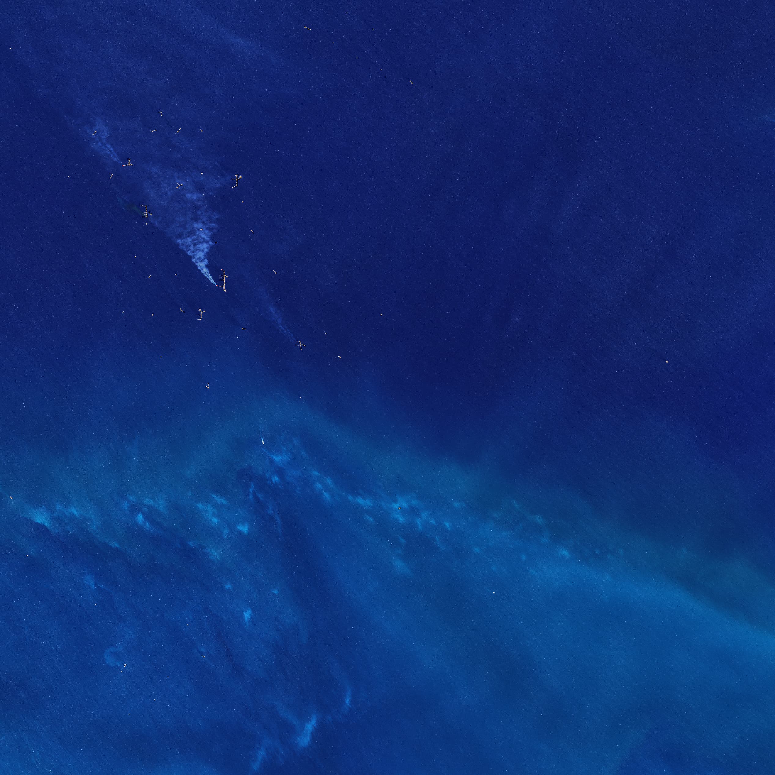
Independent checks strengthened the identification: Alejandro Franz, a pilot familiar with the region, associated the geometry with Cantarell in May 2004. In 2005 the Infraspection Institute said its review for National Geographic concluded that the hot sources were offshore flare stacks and that two-dimensional video created the impression of flight. NASA later imaged oil rigs and active gas flaring in the same Bahía de Campeche, while Pemex records Cantarell reaching peak production in 2004. Those later sources verify the industrial context; NASA's 2017 image is not evidence of conditions at the exact 2004 minute.
Release chronology and present conclusion: Maussan's 11 May press conference preceded global reporting on 12 May. Early proposals included balloons, atmospheric electricity, ball lightning and meteors; none explained the fixed platform-aligned geometry as well as flares. SEDENA's later transparency reply preserved a narrower position—authentic military observation, unknown nature, no recovered extraterrestrial material. The archive classifies the case as explained because the infrared sequence has a strong conventional identification, while retaining the ministry's historical uncertainty and the missing raw-data limitations.
Timeline
- A Mexican Air Force Merlin C-26A records unresolved infrared sources during a counter-narcotics surveillance flight near Campeche.
- Jaime Maussan presents the military tape at a press conference as an unexplained formation.
- BBC and Associated Press reporting say the Defence Ministry confirmed Air Force authorship but did not identify the lights.
- Analysts identify Cantarell oil-platform flares as the probable infrared sources; pilot Alejandro Franz independently reaches the same conclusion.
- Infraspection Institute publishes its conclusion that the thermal targets were offshore flare stacks and apparent flight was a two-dimensional illusion.
- SEDENA states that it has no physical extraterrestrial evidence, only the recorded Campeche luminous points, whose nature it did not know.
Questions about the 2004 Mexican Air Force video
Was the Mexican Air Force video authentic?
Yes as a military recording. Authentication does not identify the bright sources or make distributed copies raw sensor data.
What did the infrared camera actually measure?
It recorded radiance contrast in the 3–5 micron band. The tape alone cannot recover reliable distance, size, altitude or temperature.
Were eleven objects confirmed on radar?
No. Reported radar contacts differed in number and direction from the infrared points, and no synchronized raw radar record is public.
Why are oil-platform flares the leading explanation?
The nearly fixed camera bearing pointed toward Cantarell; zoom split clusters into multiple hot points, and aircraft motion explains their apparent drift against clouds.
Does any original 2004 footage appear on this page?
No. The local image is NASA's 2017 location background. Rebroadcast clips are not embedded or described as lossless original sensor data.
Sources
- [1] Official fileSEDENA transparency response on the Campeche recordingSecretaría de la Defensa Nacional
- [2] News reportMexico pilots release 'UFO film'BBC News
- [3] ResearchThe Campeche, Mexico 'Infrared UFO' VideoSkeptical Inquirer / Robert Sheaffer
- [4] ResearchThermography review of the Mexican Air Force tapeInfraspection Institute
- [5] Official fileGas flares in Bahía de CampecheNASA Earth Observatory
- [6] Official filePemex history: Cantarell's 2004 production peakPetróleos Mexicanos
The hero is a 2017 NASA location background, not event evidence. No compressed or rebroadcast military clip is labeled original sensor data.